
 |
| English: Merrifield Hall on the campus of the University of North Dakota in Grand Forks, North Dakota, USA. (Photo credit: Wikipedia) |

Drones: A Booming Business?: Unmanned aerial vehicles, also known as drones, may soon become commercialized. In Grand Forks, N.D., people are preparing for a coming boom in drones-related business.
By MATTHEW L. WALD
Published: March 17, 2013
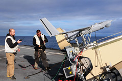
GRAND FORKS, N.D. — On the pilot’s computer screen, planted at ground level a few yards |
| English: CBP Air and Marine officers control and watch images taken by Unmanned aerial vehicles (drones) of the CBP. This surveillance provides information concerning illegal activities taking place in remote areas to Border Patrol agents. (Photo credit: Wikipedia) |
To the pilot’s right, a sensor operator was aiming a camera on the plane to pan, tilt and zoom in a search among the houses on the ground for people who had been reported missing.
On his screen, cartoonlike human figures appeared in a gathering around a camp fire between the houses.
“There they are,” Andrew Regenhard, the pilot and a student, said in a flat tone that seemed out of place with a successful rescue mission.
 |
| Seal of the University of North Dakota (Photo credit: Wikipedia) |
“The sky’s going to be dark with these things,” said Chris Anderson, the former editor of Wired, who started the hobbyist Web site DIY Drones and now runs a company, 3D Robotics, that sells unmanned aerial vehicles and equipment. He says it is selling about as many drones every calendar quarter — about 7,500 — as the United States military flies in total. ...
 |
| privacy (Photo credit: Sean MacEntee) |
 |
| English: Official photo of Senator Patrick Leahy (D-VT) (Photo credit: Wikipedia) |
Some fans of the technology wince at the word “drone,” which implies that there is no pilot. And they have grown resentful about the alarms raised over privacy issues, noting that a few city and state governments have begun banning drones even where they do not yet operate.
 |
| Men perform pre-flight checks on an unmanned aerial vehicle before launch. (Photo credit: Official U.S. Navy Imagery) |
Back in the university lab, Rico Becker, a software developer with Corsair Engineering, which had written a program for the students, emphasized that the “missing persons” exercise was just one of many hypothetical missions that students would fly, and was purely theoretical. “We’re not training pilots to spot people camping in their backyards,” he said. ...
Volunteer fire departments in places like Grand Forks, Mr. Kenville said, would provide a clear market. An unmanned vehicle, he said, was “going to beat all the cars there,” to determine the scope of a problem.
“If it’s a chemical fire, it will tell us to stay away, or it’s just some hay bales, drive slower,” he said. ...
 |
| PhotonQ-Swarming Drones (Photo credit: PhOtOnQuAnTiQuE) |
Mr. Opsahl, a former pilot on a regional jet, is now an instructor in the North Dakota program, where Mr. Regenhard, 21, a junior from Prescott, Wis., has a double major in commercial aviation and in unmanned aerial systems. Mr. Regenhard is also building a six-rotor helicopter that will beam pictures back to the ground, one that might inspect rooftop air-conditioners or offer a bird’s-eye view of a crime scene. ...
The unresolved question is how to avoid midair collisions, because the operator on the ground cannot see other traffic in the air. The F.A.A. plans to have a system ready by 2015 called “sense and avoid” in which each plane in the sky, manned or unmanned, uses GPS equipment to locate itself, and sends that information to a computer on the ground that draws a map showing all targets. The computer then rebroadcasts that map to every pilot in the air — or at a computer workstation on the ground, as the case may be.
The progress of electronics seems relentless. Mr. Anderson, of 3D Robotics, said that all the components in a drone — a fast processor, a good battery, a GPS receiver and microelectromechancial sensors — were present in an iPhone. ...
The field is embryonic. “We’re in the Wilbur Wright years of the U.A.S. industry,” said Bruce Gjovig, director of the Center for Innovation, a business incubator, at the University of North Dakota.
Benjamin M. Trapnell, an associate professor and a mainstay of the unmanned aircraft systems program here, ... said the trick was not just in learning to fly such vehicles, but also in designing them, including the cameras or other sensors they could carry, and the ground stations from which they can be controlled.
The technology seems so flexible and promising that even some companies involved in conventional aviation are interested. For example, at Applebee Aviation, which flies 11 helicopters out of Banks, Ore., mostly to spray crops, Warren Howe, the sales manager, said a remotely piloted vehicle might never replace a conventional one for that purpose. In a drone, he said, “you’re limited to looking with a camera; you wouldn’t be able to see necessarily the wind changes that control drift, or a spotted owl or something, or beehives in a neighboring yard.”
“You may not see that kid coming down the street to take a look because he thinks a helicopter is really cool,” Mr. Howe said.
But at the same time, he said, his light helicopters cost $1,100 an hour to charter, and a lot of survey work could be done with a drone instead, mapping out what a manned helicopter would be needed for.
Mr. Anderson, in contrast, said that later this year, his company would introduce a helicopter for agricultural surveillance that would sell for less than $1,000. “That’s not per hour, that’s for the helicopter,” he said.
'via Blog this'


No comments:
Post a Comment